
Thomes Pocket Camping Area Introduce
Welcome, fellow California adventurers! Are you seeking an authentic escape into the heart of Northern California's untamed wilderness? Look no further than Thomes Pocket Camping Area, a hidden gem nestled within the vast and beautiful Mendocino National Forest. Unlike crowded, amenity-rich campgrounds, Thomes Pocket offers a truly primitive and immersive outdoor experience, ideal for those who appreciate rugged beauty, self-reliance, and the tranquil sounds of nature. If your idea of a perfect getaway involves disconnecting from the everyday and reconnecting with the great outdoors, then Thomes Pocket Camping Area might just be your next favorite destination.
This extensive guide will provide you with all the essential information you need to plan your trip to Thomes Pocket, from understanding its unique location and accessibility challenges to what to expect in terms of services and highlights. We'll also cover key details to ensure you have a safe and enjoyable visit to this secluded California wilderness haven.
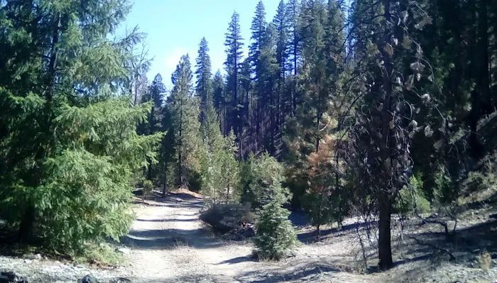
Thomes Pocket Camping Area is situated within the expansive Mendocino National Forest in California, USA. Specifically, its approximate location is designated by the plus code X4W2+9V, Griffin Place, CA, USA. This places it in a relatively remote and undeveloped part of the forest, offering a true sense of seclusion.
Accessibility to Thomes Pocket is a significant factor to consider for any visitor. Based on available information, the area is reached via Forest Road 25N34. It's important to note that access roads can be challenging. A recent visitor described parts of the road, particularly into the flat by the creek (25N34), as having "the outer edge washing out, so a full-size pickup truck has to drive on the cutbank to get around it." Additionally, Forest Road 25N34A, which leads to some potential campsites, has a spot where "the creek has cut right to the edge of the road." These descriptions strongly suggest that a high-clearance, four-wheel-drive vehicle is highly recommended, if not essential, for safe passage. Visitors should be prepared for primitive road conditions and potential obstacles. It is also advised to bring a saw and shovel, indicating that clearing small obstacles or performing minor road maintenance might be necessary to access certain areas. This remote access contributes to the area's wild and undeveloped character, making it less suitable for standard passenger vehicles or those seeking easy, paved access.
As an undeveloped campground, Thomes Pocket Camping Area offers a very limited set of services, emphasizing a rustic and self-sufficient camping experience.
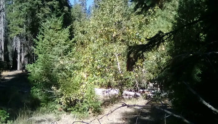
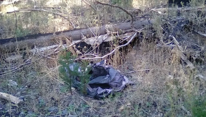
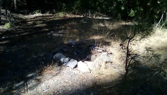
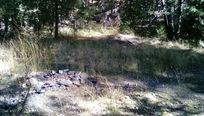
Undeveloped Campsites: The area is characterized by "five fire rings of loose rocks along the canyon," indicating informal, primitive campsites rather than designated, maintained sites with amenities. These are essentially clearings where campers have previously set up.
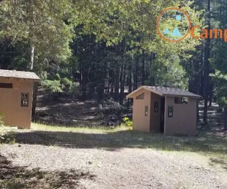
No Facilities: Based on the description of an "undeveloped campground" and the lack of mention of any structures, it is safe to assume there are no restrooms, potable water sources, trash receptacles, or picnic tables. Campers must be entirely self-sufficient, bringing in all their own supplies and packing out all waste.
Dispersed Camping Opportunities: The nature of the camping area suggests a dispersed camping environment, where campers choose their own spots within the general vicinity, adhering to Leave No Trace principles.
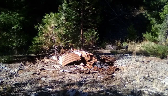
Former AS (Trailer Camp) Site: Historical information suggests the Forest Service had an "AS (apparently a trailer camp)" in the area between '86 and '89, likely in what is now referred to as the "memorial grove" campsite. While no longer active, this hints at the historical use of the flat for camping and provides a potential, albeit undeveloped, area for setting up camp.
Thomes Pocket Camping Area, despite its primitive nature, boasts several compelling features and highlights for the discerning wilderness enthusiast.
True Wilderness Experience: This is the primary highlight. Thomes Pocket offers an authentic escape from developed campgrounds and provides a deep immersion into the natural environment of the Mendocino National Forest. It's an ideal spot for those seeking solitude and a genuine connection with nature.
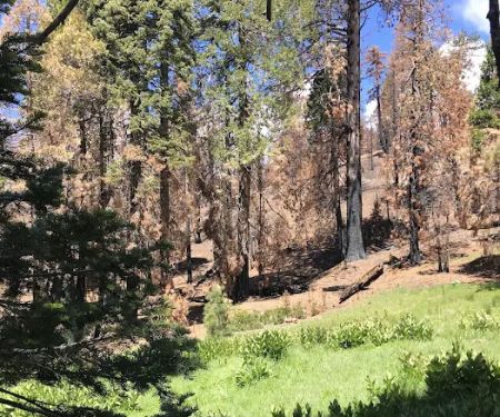
Stunning Vistas: One of the notable features mentioned by a visitor is a "good view of Sugarloaf Mountain?" from the "memorial grove" campsite and the road into the canyon. This suggests picturesque scenery and excellent opportunities for photography or simply enjoying the expansive landscape.
Undeveloped and Secluded: For campers who value privacy and quiet, the undeveloped nature and challenging access to Thomes Pocket ensure fewer crowds compared to more accessible campgrounds. This is perfect for those looking to truly get away from it all.
Historical Significance: The mention of older maps showing a recreation site and the presence of a former Forest Service trailer camp (AS) from the late 80s adds a layer of historical interest to the area.
Off-Grid Living: This location is perfect for practicing and enjoying off-grid camping skills. Campers will need to be self-reliant, managing their own water, waste, and power.
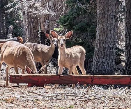
Exploration Opportunities: With the surrounding Mendocino National Forest, Thomes Pocket serves as a base for hiking, wildlife viewing, and exploring the undeveloped terrain, provided visitors are prepared for rugged conditions.
As Thomes Pocket Camping Area is an undeveloped and primitive site within the Mendocino National Forest, there isn't a direct administrative office or specific contact number for the camping area itself.
Address: X4W2+9V, Griffin Place, CA, USA
For general inquiries about the Mendocino National Forest, including road conditions, fire restrictions, or wilderness regulations, it is best to contact the relevant Ranger District office. While no specific phone number is provided for Thomes Pocket, you can find contact information for the Mendocino National Forest Supervisor's Office or its individual Ranger Districts (e.g., Stonyford, Upper Lake, Covelo) by searching online for "Mendocino National Forest contact information" or visiting the official USDA Forest Service website for the Mendocino National Forest. Always check current conditions and regulations before your visit.
For California locals yearning for a truly authentic wilderness experience, Thomes Pocket Camping Area is exceptionally suitable. If you’re tired of crowded campsites with too many amenities and long for a place where the sounds of nature prevail over human activity, this is your spot. Its undeveloped nature means you'll need to be self-sufficient, but this also ensures a level of solitude and immersion in nature that is increasingly rare. The challenging access, while a barrier for some, serves as a natural filter, preserving the tranquility for those willing and able to make the journey. The stunning views, potential for wildlife encounters, and the sheer vastness of the Mendocino National Forest surrounding it make Thomes Pocket a prime destination for experienced campers, backpackers, and anyone seeking to genuinely disconnect and embrace the rugged beauty of Northern California. It's a place where you can truly escape the urban hustle and reconnect with the wild heart of your home state, making it an ideal local adventure for the prepared and adventurous Californian.
Alternative Option
Thomes Pocket Camping Area Details
Children
- Good for kids
Parking
- On-site parking
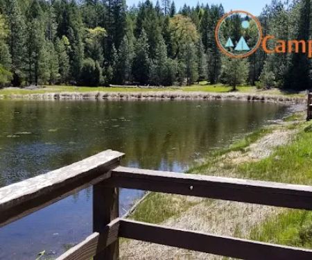
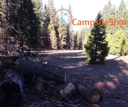
Thomes Pocket Camping Area Photos
Thomes Pocket Camping Area Location
Thomes Pocket Camping Area Reviews
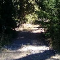
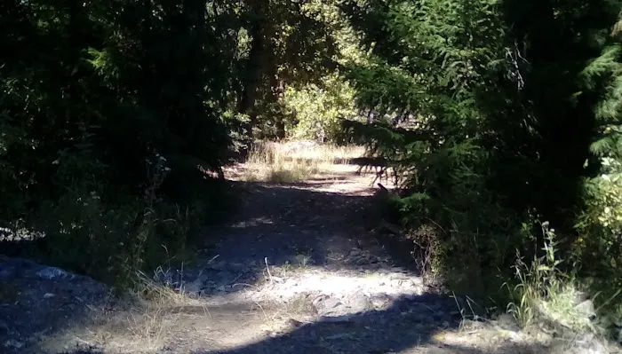
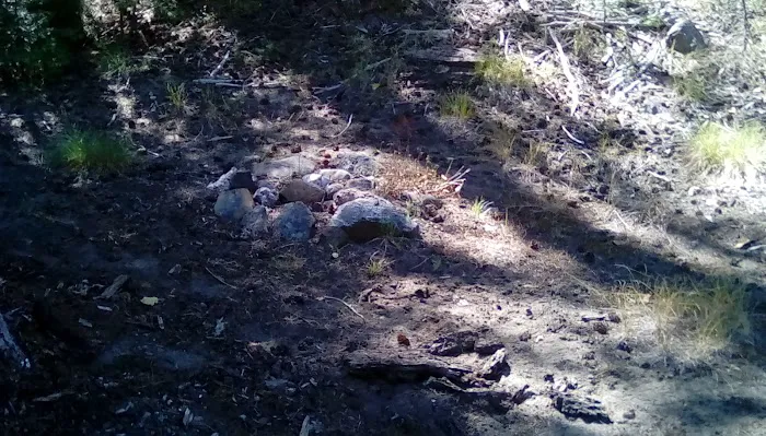
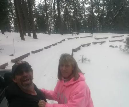
This area is where the 2012 Mendocino National Forest map shows the camping area. Older maps show the recreation site (undeveloped campground) in section 19 by a seasonal side stream around the end of FR 25N34A, which is no longer passable if the maps were correct about the road going that far up the canyon by the wilderness boundary. I found five fire rings of loose rocks along the canyon in this area, the last one being on the northeast side of the creek on a road-like flat. The maps show the road staying on the southwest side of the creek. The road into the flat by the creek (25N34) has the outer edge washing out, so a full-size pickup truck has to drive on the cutbank to get around it. There is a good view of Sugarloaf Mountain? from the "memorial grove" campsite and the road into the canyon. 25N34A also has a spot past the "memorial grove" campsite where the creek has cut right to the edge of the road. Bring a saw and shovel to visit this place. FS had an AS (apparently a trailer camp) around here at least from '86-'89. It was probably in the grove when you first get to the flat.
October 16 · Fire Buff
More Camping Near Me
 Green Springs Campground0.0 (0 reviews)
Forest Rte M2, California, USA
 Hammerhorn Campground5.0 (4 reviews)
Pacific Crest Rd, Covelo, CA 95428, USA
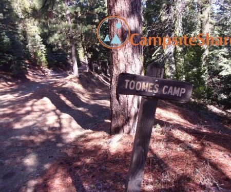 Toomes Camp1.0 (1 reviews)
Mendocino, CA, USA (40.003004, -122, 759022, CA, USA
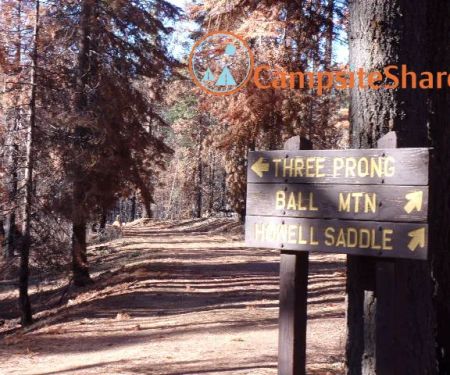 Three Prong Campground4.0 (5 reviews)
Paskenta, CA 96074, USA
 Big Stump4.0 (1 reviews)
Forest Rte 24N22, California, USA
 Little Doe Campground3.0 (6 reviews)
Covelo, CA 95428, USA
 Kingsley Glade Campground3.0 (2 reviews)
Forest Rte 24N01, California, USA
 Sugar Spring Campground0.0 (0 reviews)
Forest Rte 23N69, Paskenta, CA 96074, USA
 Howard Meadows Campground4.0 (4 reviews)
Unnamed Road, Covelo, CA 95428, USA
 Sugarfoot Glade Campground4.0 (4 reviews)
Fiddlers Green, CA 96134, USA
 Wells Cabin Campground4.0 (4 reviews)
Covelo, CA 95428, USA
 Whitlock Campground4.0 (8 reviews)
Forest Rte 24N19, Red Bluff, CA 96080, USA
Categories
Top Visited Sites
 Lee Villa Mobile Home Park3.0 (94 reviews)
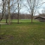 Creek Park4.0 (13 reviews)
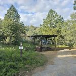 Lion Spring Camp5.0 (2 reviews)
 Pinecrest Mobile Home Community3.0 (49 reviews)
 Bonnaroo group campsite4.0 (12 reviews)
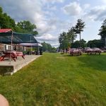 Lake Hadlock LLC4.0 (38 reviews)
Top Camping Searches
Trending The Campfire Posts
 Best Campsites for Mountain Biking in National Parks
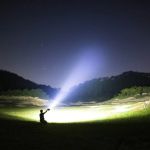 Best Headlamps and Lanterns for Camping: Light Up Your Outdoor Adventure
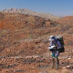 How to Use Natural Navigation Methods While Camping
 How to Choose the Best Camping Location: Expert Tips for Every Camper
 Campfire Cooking for Beginners: Easy Meals and Tips for Success
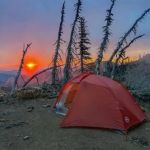 How to Stay Safe During Solo Camping Trips: Essential Tips