
Japanese Bombing Site Trailhead (recgovnpsdata) Introduce
Nestled within the rugged beauty of the Siskiyou National Forest near Harbor, Oregon, lies a destination that offers much more than just a hike: the Japanese Bombing Site Trailhead. This unique site provides a fascinating glimpse into a rarely told chapter of American history, commemorating the only time the contiguous United States was bombed by enemy aircraft during World War II. For Oregonians seeking an outdoor adventure infused with significant historical context, this trail offers an experience unlike any other.
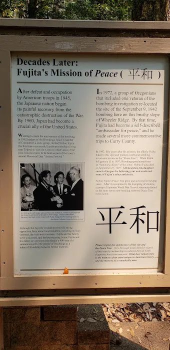
The Japanese Bombing Site Trailhead (recgovnpsdata) refers to an interpretive trail that leads to the location where, on September 9, 1942, a Japanese floatplane, launched from a submarine, dropped incendiary bombs with the intention of starting a massive forest fire. While the bombs caused only minor damage due to damp weather and the swift actions of U.S. Forest Service lookouts, the event remains a poignant reminder of the war's global reach and its unexpected touch on the tranquil Oregon coast.
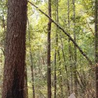
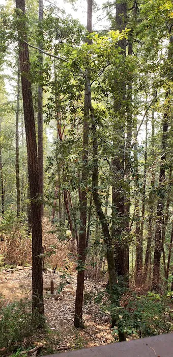
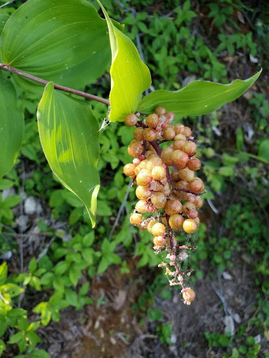
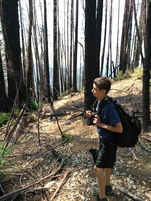
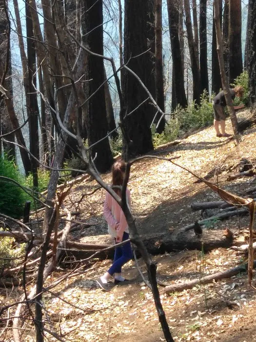
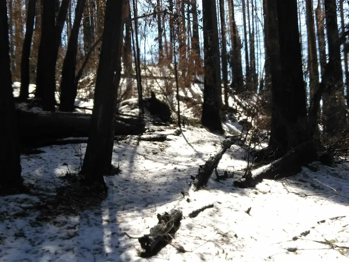
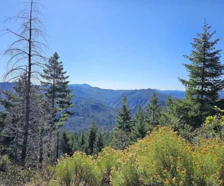
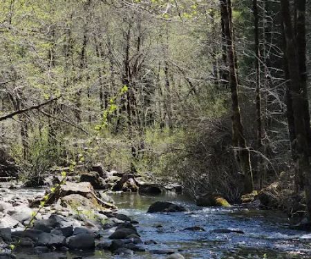
Visiting this site is not just about witnessing a historical marker; it's about experiencing the resilience of nature and understanding the efforts made to preserve this unique piece of the past. The trail itself, though relatively short, guides you through a landscape that has recovered from significant natural events, including recent wildfires, demonstrating the enduring spirit of the Oregon wilderness. It's a journey that combines physical activity with intellectual engagement, making it a compelling outing for history buffs, nature lovers, and curious locals alike.
The Japanese Bombing Site Trailhead is located near Harbor, Oregon, with its general address being Harbor, OR 97415, USA. More specifically, it's situated within the vast expanse of the Siskiyou National Forest, roughly 19 miles east of Brookings, Oregon. The site can be reached by taking Curry County Road 808 to Forest Road 1205, and then connecting to Spur 260.
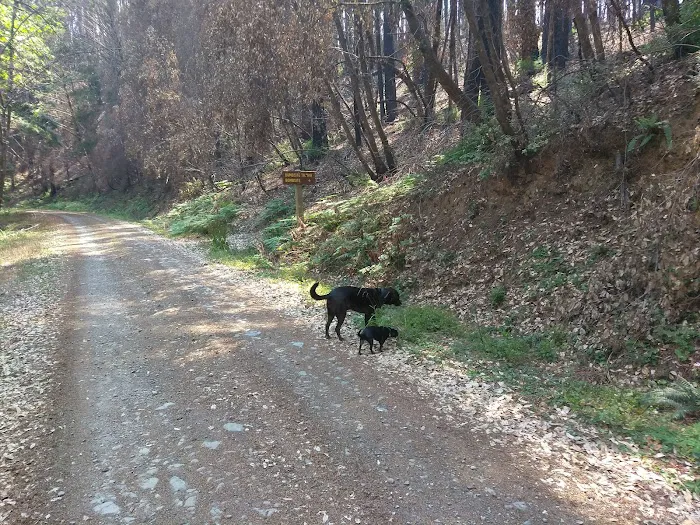
It's important for visitors to be prepared for the journey to the trailhead, as accessibility is a key consideration. As noted by past visitors, the drive involves approximately 13 to 15 miles along a dirt or gravel road, which can be rough, especially after adverse weather or forest events like the 2017 Chetco Bar Fire. One reviewer explicitly stated, "The drive is rough... but very worth the hike," while another mentioned "difficulty in driving there and the lack of signage along the way. Be prepared to drive about 15 miles along a dirt road to get there." This means a vehicle with good ground clearance is advisable, and visitors should exercise caution and drive slowly.
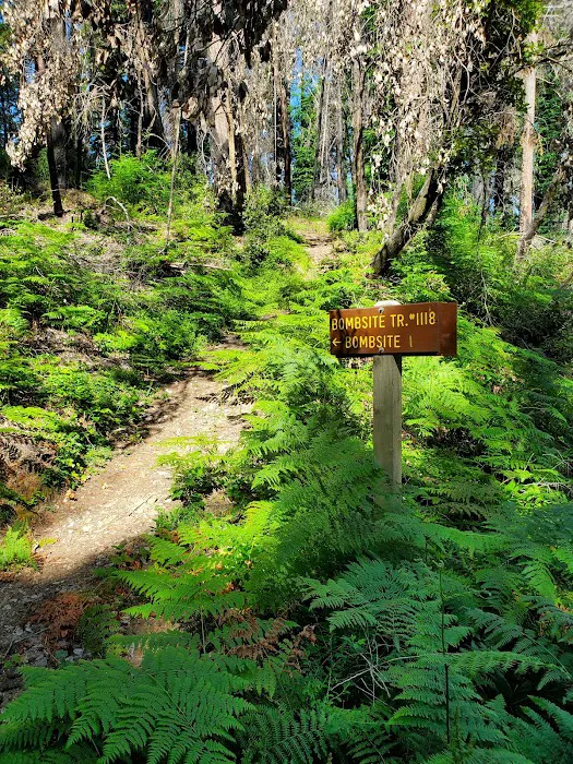
Despite the somewhat challenging access, the Forest Service aims to make the trail itself manageable. The trail is designated as Trail #1118, and its length is approximately 1.5 to 1.6 miles round trip. The elevation change is relatively minor, around 100 feet. While the drive can be rugged, the actual hike is generally considered "easy" in terms of difficulty, making it accessible for families and individuals of various fitness levels who are prepared for the unpaved road. Limited parking is available near the intersection of Forest Roads 1205 and 260, with a short walk to the trail's beginning.
As a historical interpretive site located in a national forest, the Japanese Bombing Site Trailhead (recgovnpsdata) offers a more rustic experience compared to developed campgrounds with extensive amenities. The focus here is on the historical significance and natural environment. Therefore, visitors should manage expectations regarding on-site services.
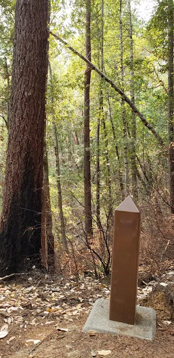
- Informational Signage: A primary "service" of this site is the comprehensive interpretive information provided. Despite the surrounding trees not surviving the Chetco Bar Fire, past visitors were impressed that "great informational signs/boards and a deck overlooking the area, that all surprisingly survived." These signs are crucial for understanding the historical context of the bombing incident.
- Viewing Deck: There is a small deck overlooking the actual bomb site. This provides a designated and safe vantage point for visitors to observe the area and reflect on its history.
- Trail Access: The well-defined Japanese Bombing Site Trail #1118 is maintained to provide clear access to the historical marker.
- Parking: Limited parking is available near the trailhead, although it is suggested to park near the intersection of Forest Roads 1205 and 260 and walk the short distance to the trail's start.
- No Potable Water: Visitors should plan to bring their own drinking water, as potable water is not available at the trailhead or along the trail.
- No Restrooms: There are no restrooms directly at the trailhead or along the interpretive trail. Visitors should plan accordingly before arriving at the site.
- No Camping Facilities: It's important to note that this is a trailhead and historical site, not a campground. There are no designated camping spots, fire rings, or other typical campground amenities. For camping, visitors would need to seek out designated campgrounds or dispersed camping areas within the surrounding national forest, adhering to all local regulations.
The Japanese Bombing Site Trailhead offers several distinct features and highlights that make it a compelling visit:
- Historical Significance: The foremost highlight is its place in history as the location of the only aerial bombardment of the contiguous United States by an enemy aircraft during World War II. This unique historical marker provides a powerful connection to a pivotal global event.
- Interpretive Experience: The trail is designed to be highly educational. Robust informational signs and boards provide detailed accounts of the bombing event, the pilot Nobuo Fujita (who later returned to Brookings as a gesture of peace), and the historical context, making the visit truly informative.
- Resilient Landscape: The trail offers a firsthand look at a forest that has endured not only a historical attack but also recent wildfires (like the Chetco Bar Fire in 2017). Observing the recovery and regrowth of the surrounding trees provides a poignant testament to nature's resilience.
- Accessible Hike: Despite the challenging drive to get there, the trail itself is relatively short (1.5-1.6 miles round trip) and generally easy, with minimal elevation gain (about 100 feet). This makes it suitable for a wide range of visitors, including families.
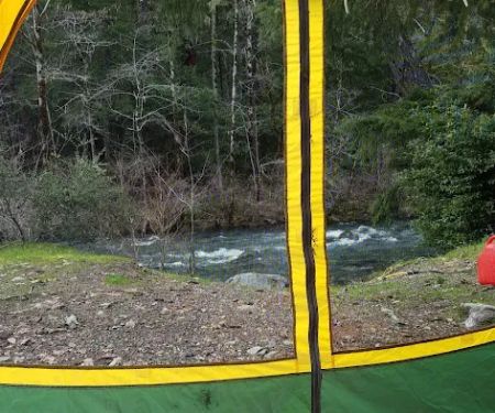
- Secluded Setting: The remote location, reached via a lengthy dirt road, contributes to a sense of peaceful seclusion. This allows for a contemplative experience, far from typical crowds.
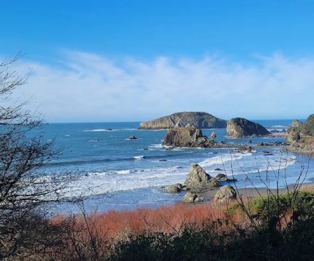
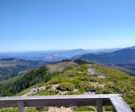
- Scenic Views: Even without grand vistas, the journey through the forest and the site itself offer quiet, natural beauty characteristic of the Siskiyou National Forest.
- Educational Opportunity for All Ages: The combination of historical narrative and a walk in nature provides an engaging educational experience for both adults and younger visitors, fostering an appreciation for history and the environment.
- Symbol of Peace: The historical narrative extends to the later visits of the Japanese pilot, Nobuo Fujita, who returned to plant a tree of peace at the site. This adds a layer of reconciliation and goodwill to the historical significance, making it more than just a war memorial.
For more information about the Japanese Bombing Site Trailhead (recgovnpsdata) and other recreational opportunities in the surrounding area, you can contact the managing agency, the U.S. Forest Service, particularly the district office responsible for this section of the Siskiyou National Forest.
Address:Japanese Bombing Site TrailheadHarbor, OR 97415, USA (General area)
For specific inquiries about the trail, conditions, or the Rogue River-Siskiyou National Forest, which manages this site, the Chetco Ranger District is the most relevant contact.
Chetco Ranger District539 Chetco Ave.Brookings, OR 97415
Phone:(541) 469-2196
You can also visit the official USDA Forest Service website for the Rogue River-Siskiyou National Forest for updated information, alerts, and detailed recreation guides. Always check current conditions, especially regarding road access and fire restrictions, before planning your trip.
For Oregonians, the Japanese Bombing Site Trailhead is far more than just a historical marker; it's a profound local treasure that offers a unique blend of history, nature, and quiet reflection. This site is particularly suitable for locals for several compelling reasons.
Firstly, it provides an accessible yet off-the-beaten-path adventure. While the drive on a dirt road requires some preparation and a suitable vehicle, it leads to a relatively easy and short hike, making it a feasible day trip for many Oregon residents looking to explore their own backyard. It’s an opportunity to discover a significant piece of World War II history that occurred right here in Oregon, offering a tangible connection to events that shaped the world.
Secondly, the site serves as a powerful educational resource. The well-preserved informational signs allow visitors to delve into the details of the 1942 bombing, understanding its context and the remarkable story of Nobuo Fujita's later gestures of peace. For families, it’s an engaging way to teach children about history, resilience, and the power of reconciliation, all while enjoying the fresh air of the national forest.
Finally, the Japanese Bombing Site Trailhead stands as a testament to the enduring beauty and resilience of Oregon's natural landscapes. Visitors witness firsthand how the forest has recovered from both the historical incident and more recent wildfires. It’s a reminder of the dynamic nature of our environment and the importance of stewardship. For those who appreciate the quiet solitude and raw beauty of the Oregon wilderness, combined with a deep historical narrative, this site is an essential visit. It offers a chance to disconnect from modern distractions and connect with a unique piece of local and national heritage, making it a truly enriching experience for any Oregonian.
Alternative Option
Japanese Bombing Site Trailhead (recgovnpsdata) Details
Activities
- Hiking
Japanese Bombing Site Trailhead (recgovnpsdata) Photos
Japanese Bombing Site Trailhead (recgovnpsdata) Location
Japanese Bombing Site Trailhead (recgovnpsdata) Reviews
4 stars because of the difficulty in driving there and the lack of signage along the way. Be prepared to drive about 15 miles along a dirt road to get there. The actual hike and site is interesting. Only about 1.5 miles round trip down the trail
August 04 · Wendy HeleneThe drive is rough, especially after the fires in 2017, but very worth the hike. The site itself is just a history marker, but there are great informational signs/boards and a deck overlooking the area, that all surprisingly survived the Chetco Bar Fire, as the surrounding trees did not.
November 21 · Greg RIf you have a 4 wheel drive and you are fit and healthy then you will enjoy the visit. If you're not fit or don't have 4 wheel drive then it's not a good idea trying to get there as it's a long hike from where you park to the memorial and it's up hill most of the way. Also the road is unpaved and pretty tricky to drive.
December 31 · Tony HobbsGreat historical site of American history lost to the the rest of the world and younger yuppies
June 01 · Mike Sanders- July 11 · John Jarchow
More Camping Near Me
 Ludlum Campground4.0 (42 reviews)
Brookings, OR 97415, USA
 Burns RV Park1.0 (1 reviews)
1092 Winchuck River Rd, Brookings, OR 97415, USA
 Miller Bar Campground4.0 (51 reviews)
Miller Bar, Brookings, OR 97415, USA
 Redwood Bar4.0 (37 reviews)
Brookings, OR 97415, USA
 South Fork Camps Campground4.0 (24 reviews)
Brookings, OR 97415, USA
 Zred Mountain Prairie Dispersed Camp-Not Enabled5.0 (1 reviews)
Oregon, USA
 Harris Beach State Park Campground4.0 (249 reviews)
Harris, Beach State Park Road, Brookings, OR 97415, USA
 Ruby Van Deventer County Park4.0 (256 reviews)
CA-197, Crescent City, CA 95531, USA
 Crescent City / Redwoods KOA Holiday4.0 (852 reviews)
4241 US-101, Crescent City, CA 95531, USA
 Dispersed Camping Patrick Creek4.0 (9 reviews)
Gasquet, CA 95543, USA
 Snow Camp Lookout4.0 (9 reviews)
Gold Beach, OR 97444, USA
 Shelly Creek Campground3.0 (12 reviews)
Gasquet, CA 95543, USA
Categories
Top Visited Sites
 BARNES R.V. & MOBILE HOME PARK4.0 (59 reviews)
 Hillview Mobile Home Park3.0 (5 reviews)
 Lake Antoine Camp Grounds4.0 (200 reviews)
 Meadowview Commons3.0 (24 reviews)
 Galaxy Manor Manufactured Home Community3.0 (41 reviews)
 Alpine Oaks Estates3.0 (16 reviews)
 How to Choose the Right Backpack for Camping: Expert Tips & Real Advice
 Best Campfire Snacks for Backpackers and Hikers
 Best Campfire Snacks for Night Owls
 The Best Campfire Songs for Romantic Evenings
 How to Stay Safe From Poisonous Plants and Insects While Camping
 How to Build a Campfire in the Forest